
Gun Moor: Two Epic Views from One Hidden Summit
Part of the Great Cheshire Views series
Route Summary
Distance: ~4.5 miles
Ascent: ~500ft (nearly all on the final road climb)
Grade: Easy to moderate
Start: Small roadside pull-in on the Meerbrook Road, above Rushton Spencer
Terrain: Open moorland, woodland path, farm tracks, quiet country lane
Highlight: Trig point panorama — Cheshire Plain one way, Peak District moorlands the other
Pub: The Lazy Trout, Meerbrook
The view before you've even started
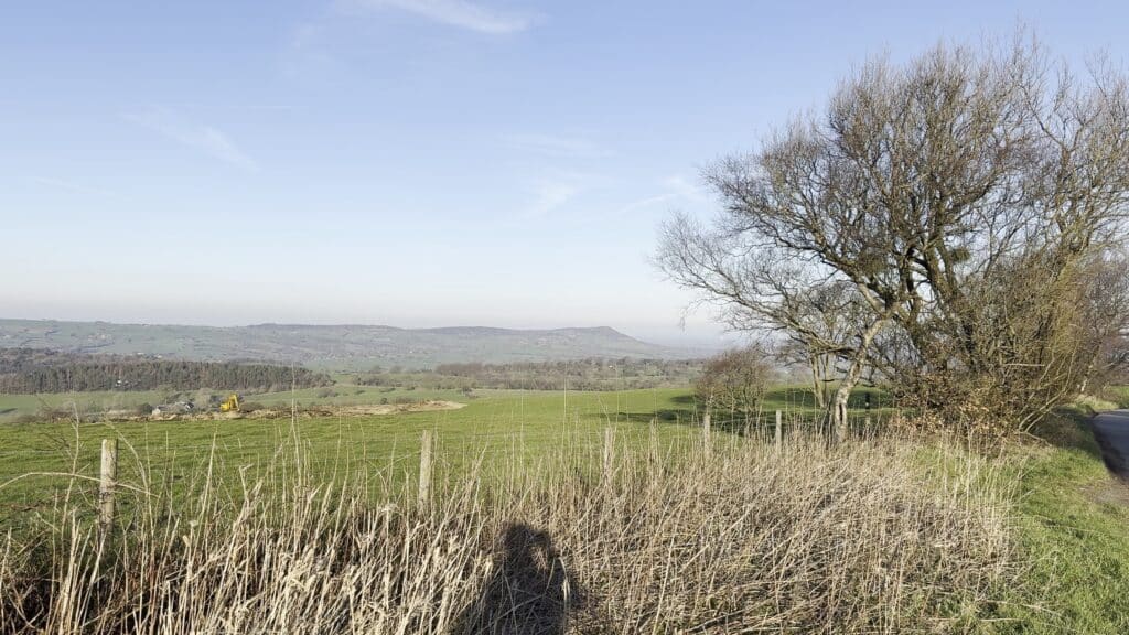
There are walks where the reward comes after the effort. Gun Moor isn’t one of them. You pull off the Meerbrook Road just where it climbs up out of Rushton Spencer, get out of the car, and before you’ve so much as laced your boots the whole of the Cheshire Plain is sitting there in front of you like somebody’s unfolded a map across the valley.
That flat-topped ridge dominating the view is Bosley Cloud — or just “The Cloud” to anyone local. If you’ve been following the Great Cheshire Views series you’ll have seen it before; there’s a sunrise walk on the channel that goes from The Cloud out to the Bridestones and is one of my favourite videos on the whole site. Beyond it, the Plain rolls away to the west, and on a clear day you can pick out the Welsh hills on the horizon.
And this is just the car park.
Today’s route takes you up onto Gun Moor itself, to a trig point that delivers the best trick of the whole series: from the top you get not one but two completely different panoramas. Then it’s down through some wonderfully gnarly old woodland, along a farm track with the Roaches laid out in front of you, and — if you fancy it — a detour into the village of Meerbrook where the Lazy Trout pub may or may not have influenced my route planning.
There is, it must be said, a sting in the tail. More on that later.
Onto the moor
Cross the road and there’s a clear path heading straight up onto Gun Moor. The sense of openness hits you immediately. You’re on a boundary here — literally. Behind you, down in the valley, is Cheshire. Ahead, the moorland climbs up towards the gritstone country of the Staffordshire Moorlands and the southern Peak District. Two very different worlds, stitched together by this single footpath.
As you gain a little height the Cheshire view only gets better. The Cloud stays front and centre — 343 metres of millstone grit, shaped first in the Carboniferous period about 315 million years ago and then scoured into its distinctive profile by glaciers during the last Ice Age. It’s a working hill as well as a looker. The gritstone was quarried to build the lock gates at Bosley on the Macclesfield Canal, and in 1849 a huge amount of it was lowered down the hillside on an aerial ropeway to build the twenty-arch railway viaduct at North Rode. If you look carefully at the western face of The Cloud you can still see the groove where all that stone came away.
Over to the right of The Cloud is Bosley Minn, and beyond that Croker Hill with its telecommunications mast on top — both featured on earlier walks in the series.
Gun Moor itself
The whole hillside here is a nature reserve, managed by the Staffordshire Wildlife Trust since they acquired it in 2019. In summer the wet heath areas are alive with cotton grass, bog asphodel and cross-leaved heath, and the bird life — curlew, snipe, cuckoo, lesser redpoll — is genuinely special.
Gun Hill itself sits at 385 metres, or 1,263 feet in old money. What earns it proper respect among hill-baggers isn’t the altitude but the prominence: it rises 168 metres above the surrounding terrain, which makes it a Marilyn — the informal classification for any British hill with at least 150 metres of prominence, regardless of its absolute height. In other words, Gun is a proper hill in its own right. It’s not just a shoulder of something bigger.
As for the name, nobody really knows for certain. The most likely origin is an old word for a spring or water source, which would make sense of the boggy summit plateau.
The trig point, and the big reveal
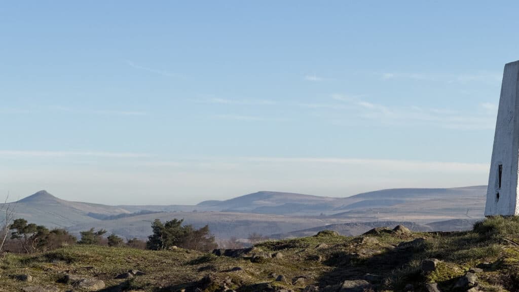
The path leads you gradually across the moor to the trig point — and this is where Gun earns its reputation.
To the west, the view you’ve been building towards all the way up. The Cloud on the left. Bosley Minn and Croker Hill on the right. And between them, the flat green-and-brown chequerboard of the Cheshire Plain spreading away to the Mersey and beyond. It’s the classic Great Cheshire View, and it would be reason enough to climb Gun on its own.
Now turn around.
This is the bit that surprises people. Suddenly you’re looking out over a completely different landscape — Staffordshire moorland, with the town of Leek nestled in the valley below, and rising above it some of the most theatrical ridges in the Peak District.
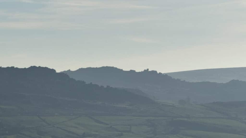
That long, dark escarpment is The Roaches. The name comes from the French “roches” meaning rocks, brought here by Norman settlers after 1066. The ridge tops out at over 500 metres, and it’s one of the most iconic skylines in the whole national park — Bronze Age burial urns have been found up there, and the dark pool at the top, Doxey Pool, is supposedly home to a mermaid called Jenny Greenteeth who lures unwary walkers to a watery end.
To the right of the Roaches, that isolated rocky cone is Hen Cloud, standing sentry at the southern end of the ridge. Further right again, that’s Ramshaw Rocks — and somewhere in there is the Winking Man, a rock buttress whose profile looks exactly like a face and whose eye appears to wink at you as you drive past on the Buxton road.
Down in the valley you’ll catch the glint of water. That’s Tittesworth Reservoir — and it carries a slightly melancholy history. There’s been a reservoir here since 1858, built to regulate the River Churnet for the mills downstream. But when it was massively extended in the early 1960s, nine properties in Meerbrook village were flooded to make way for the new dam: farms, a garage, the old Fountain Inn. Part of the village simply disappeared underwater. It’s the same story as so many reservoirs across Britain — progress at a cost.
And over to the north-east, that distinctive pointed summit is Shutlingsloe, sometimes (a little optimistically) called the Matterhorn of Cheshire. A brilliant little hill, and another one I’ve covered on the channel.
What I love about being up here is that Gun sits at the hinge point between two worlds. To one side, the old agricultural heartland of Cheshire and the north-west. To the other, the wild moorland and gritstone edges of the Peak. You can see pretty much every other walk in this series from up here. And almost no one comes to Gun compared to the crowds on the Roaches or Shutlingsloe. That’s the whole point of it.
Down through the old woodland
From the trig the path splits. Both options lead to the same place, so take whichever you fancy — I went right.
What follows is one of my favourite sections of the walk. The path drops down through old, gnarled woodland — and I say old deliberately, because these aren’t tidy plantations. They’re wind-battered trees, bent and scarred by decades of exposure on the high ground. Hawthorn, rowan, some twisted old oak. Everything growing at an angle. This kind of semi-natural scrub woodland on moorland edges often persists for centuries because the trees are too tough and too awkward for anyone to have bothered clearing them. There’s a quiet wildness to it that I find wonderful.
Eventually the trees thin and you drop down onto a single-track lane. Turn left here and you can loop straight back to the start for a shorter day. But go right, over the cattle grid, and the best of the return route opens up.
Farm tracks and the Roaches view
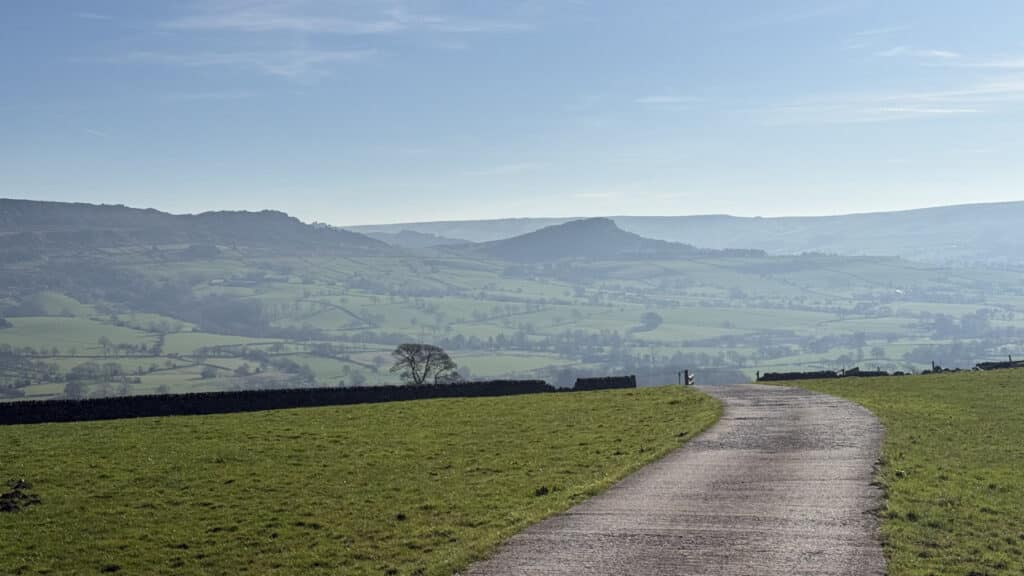
Beyond the cattle grid you’re on good solid farm track heading gradually downhill, with the Staffordshire panorama laid out in front of you. The Roaches stretches ahead, Hen Cloud tucked in below it, and the whole escarpment takes on a theatrical quality — like a stage set for something dramatic about to begin.
All of this gritstone — the Roaches, Ramshaw Rocks, Hen Cloud, The Cloud — is Namurian-age sandstone laid down about 320 million years ago as delta sediments from great rivers draining a now-vanished mountain range to the north. It’s been thrust up, tilted, and then slowly carved into these dramatic edges by millions of years of weathering. What you’re walking through is essentially the skeleton of an ancient world, stripped back to its bones.
Just before you reach the farm ahead, the footpath leaves the track and cuts across the fields. You’ll pass through a couple of classic Staffordshire Moorlands farmyards — working farms, real ones — so keep to the path, say hello to the sheepdogs, and admire them doing a much better job of herding than any of us ever will.
Meerbrook and the Lazy Trout
The path drops down onto Gun Hill Road. Turn right for a fairly direct return to the car. Turn left, though, and just around the next bend is Meerbrook.
Meerbrook is a tiny village in the parish of Leekfrith, sitting about four miles north of Leek. It’s the sort of place that feels like it exists slightly outside of time. The church of St Matthew was built in the 1870s, but the settlement goes back much further — the area grew with the medieval wool trade, and the Cistercian Abbey of Dieulacres, just outside Leek, held sheep farms here in the Middle Ages. Not far from here is the site of Wincle Grange, land given to the monks of Combermere Abbey in the late 12th century for sheep-farming, the wool sold at Boston Fair in Lincolnshire for export to continental Europe. These hills have been farmed for a very long time.
From the road you can see Tittesworth shimmering in the valley below. It’s easy to forget that part of old Meerbrook is down there, under that water.
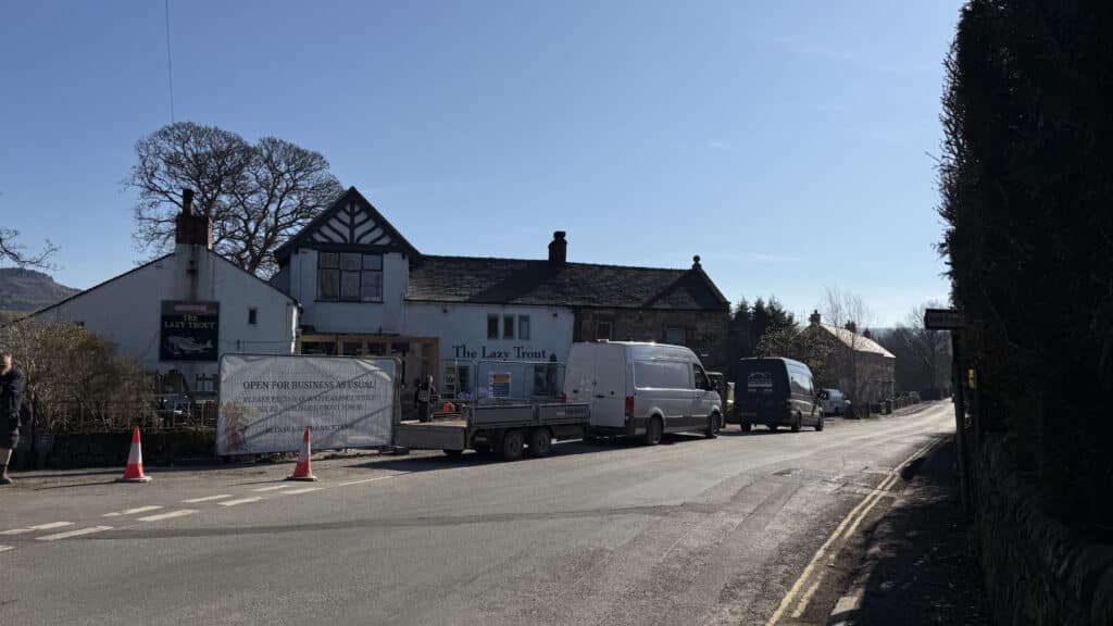
And then — the Lazy Trout.
The pub began life as two 16th-century cottages before being converted into a Victorian coaching house. It was originally called the Three Horseshoes, but there was another Three Horseshoes less than two miles away, which I imagine caused no end of confusion for travellers. Hence the rebrand. The views from the beer garden are, shall we say, not bad, and it felt only right to mark the occasion before turning round and heading back.
Route Map & GPX
Get the full route map and GPX file here:
Share this route with your friends
Support us on Patreon
You can help the channel by following these affiliate links and buying things

🔗 OTHER VIDEOS FROM TODAY’S VIEW
You can see all of these from the top of Gun Moor — here’s where I’ve explored them:
☁️ Bosley Cloud (The Cloud) — Sunrise Walk to the Bridestones
🚂 Rushton Spencer to Rudyard Lake
⛰️ Bosley Minn & Croker Hill 👉 https://youtu.be/x748TaqbccE
Your might also be interested in..